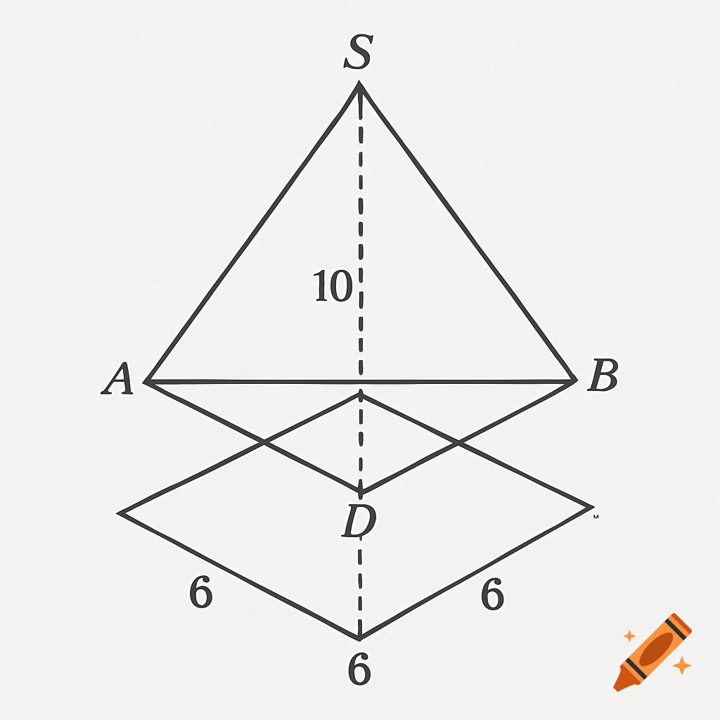
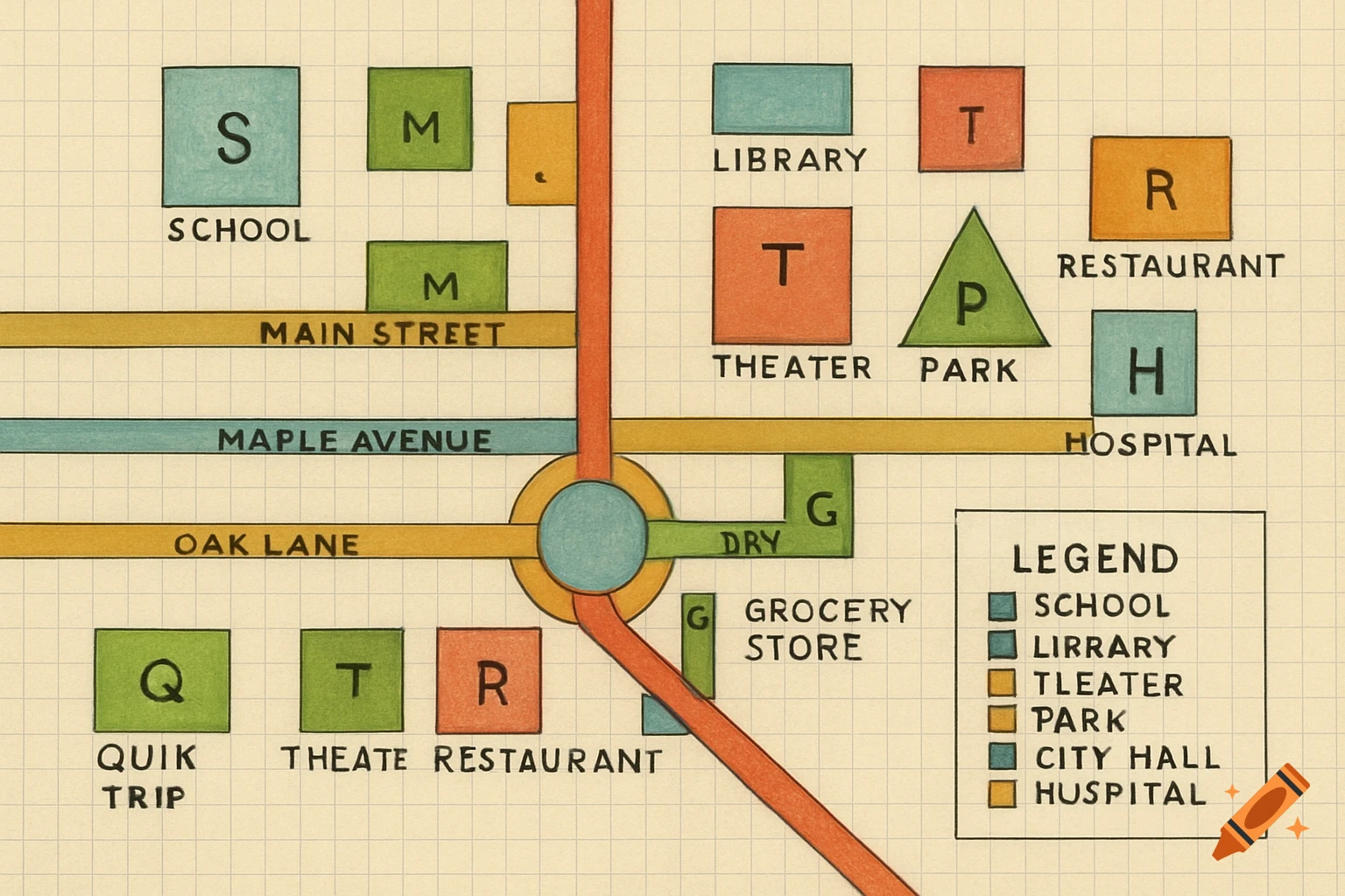
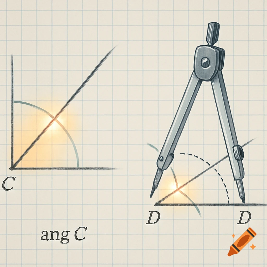
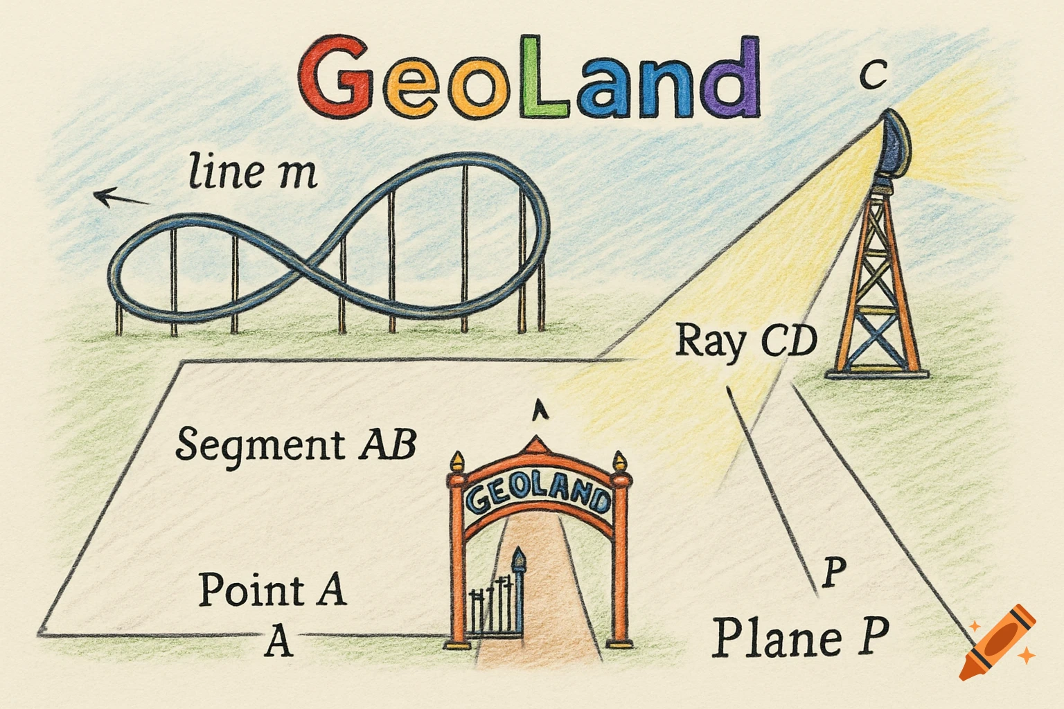
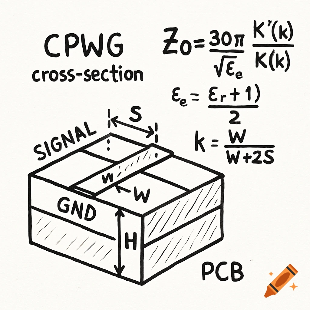
A hand-drawn diagram resembling a map, labeled with geometric terms, angles in degrees, and mathematical formulas.
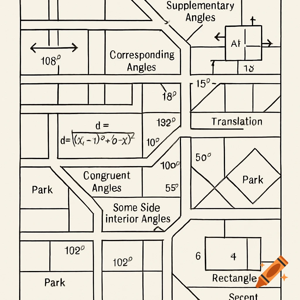
Illustrate a city map that includes the geometry vocabulary I mentioned. Here’s a step-by-step guide to help you create it: 1. Draw the Base Map: Start with a rectangular outline of your city. 2. Lines: Draw straight lines to represent streets. Make sure some streets intersect. 3. Degree: At the intersections, measure and label angles using degrees (for example, a 90-degree angle for a right turn). 4. Distance Formula: Choose two points (like two parks) and calculate the distance between them using the distance formula: d = sqrt((x2 - x1)² + (y2 - y1)²). 5. Supplementary Angles: Identify pairs of angles at intersections that add up to 180 degrees. 6. Complementary Angles: Find angles that add up to 90 degrees at certain intersections. 7. Parallel Lines: Draw two streets that run alongside each other without ever meeting. 8. Corresponding Angles: Where two streets cross, label the angles in matching corners as corresponding angles. 9. Congruent Angles: Identify angles that are equal in measure at different intersections. 10. Same Side Interior Angles: Label angles on the same side of a transversal (a street crossing another) that add to 180 degrees. 11. Right Triangle: Include a section of the map that forms a right triangle, such as a park or building corner. 12. Translation: Show how a shape (like a park) can be moved to another spot on the map. 13. Rectangle and Square: Draw buildings or parks in rectangular or square shapes and label their dimensions. 14. Secant: If you See more