Create
Remove BG
Search
Categories
Tutorial
My images
Upgrade to Pro
Help
Pro
Sign up
Retouch
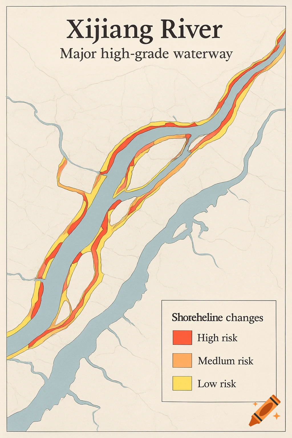
帮我生成一张西江重要高等级航道岸线变化图斑提取的图,图斑需要标记三个颜色,红色为高风险(侵占航道或堤防脚线),橙色中风险(侵蚀>10 m或扩张>8 m),黄色低风险(其他)。需要图例,图例为红色为高风险、橙色中风险、黄色低风险 See more
Infos
Get it on a shirt