An illustrative map of Badolato Marina, Italy, showing coastal features, risk zones in red and yellow, and green safe zones, with prominent waves in a stylized, distressed art style.
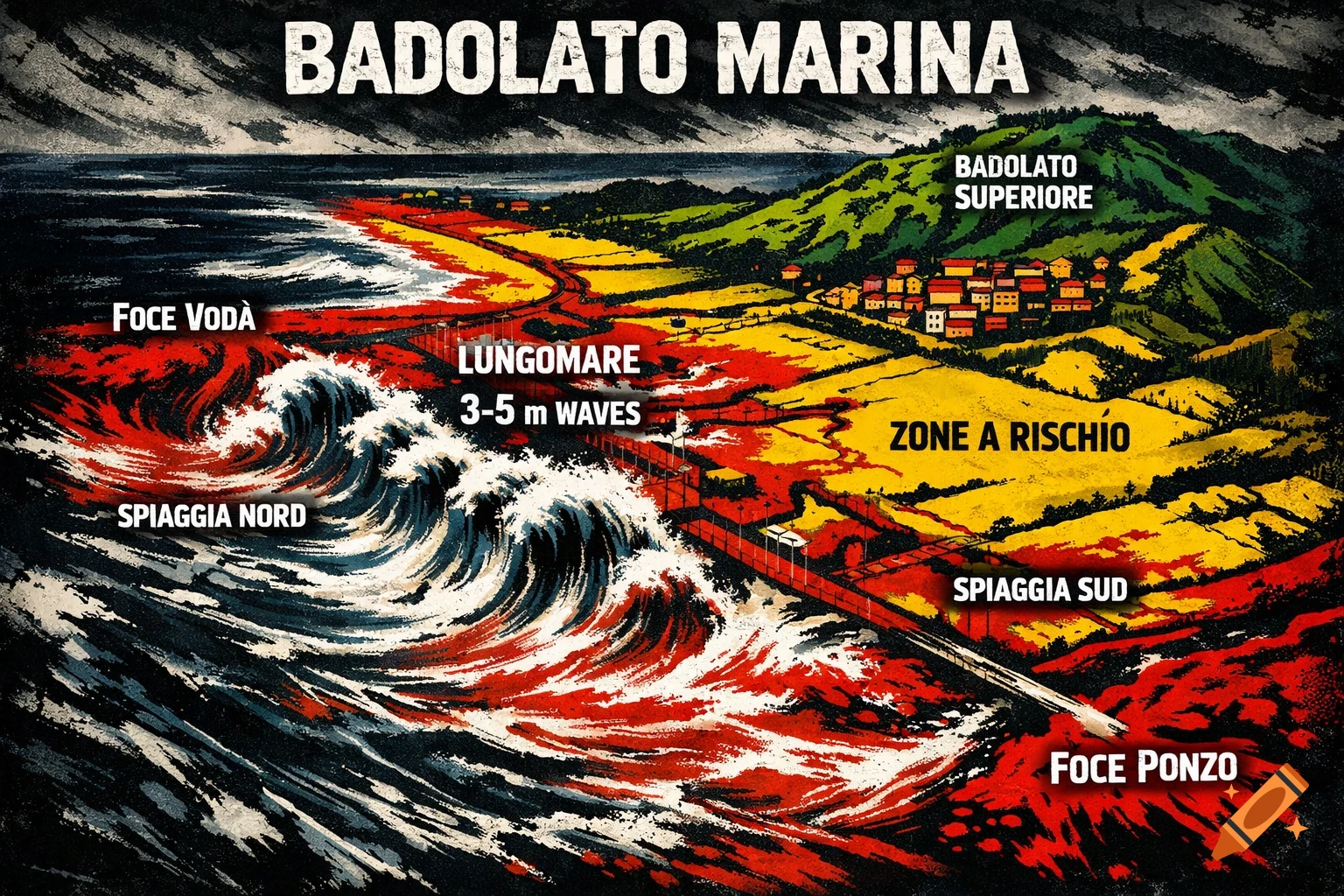
NORTE (Torrente Vodà) --------------------- <-- Alto rischio (rosso): Foce Vodà allagata, esondazione | Spiaggia Nord | | [ROSSO] | --------------------- | Costa Ionica | --------------------- | Lungomare Centrale | <-- Alto rischio (rosso): Sovralavamento onde 3-5m costa | [ROSSO] | --------------------- | Spiaggia Sud | | [ROSSO/GIALLO] | --------------------- <-- Foce Ponzo SUD (Torrente Ponzo) Zone moderate (giallo): Vie basse fino 200m inland, campi agricoli. Zone sicure (verde): Badolato Superiore (elevato). Vodà (NORD) [ROSSO: Foce allagata] | Spiaggia [ROSSO] -- Lungomare [ROSSO] -- Spiaggia Sud [ROSSO] | Ponzo (SUD) [ROSSO: Esondazione] Retroterra basso [GIALLO] | Elevato [VERDE] Crea una mappa con queste cose di badolato marina See more