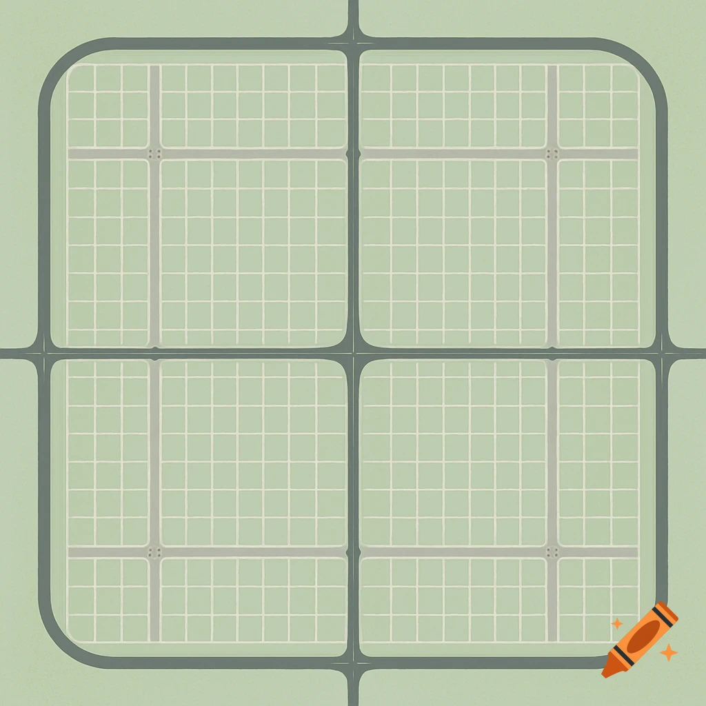
A clean, 2D bird's-eye view of a square city grid with pastel green blocks, dark charcoal freeways, and gray roads, featuring rounded corners and precise alignment.
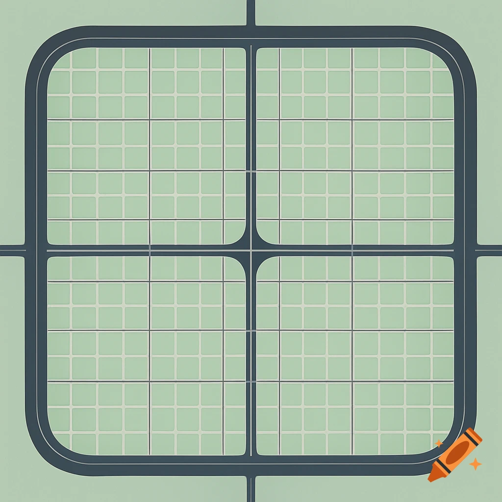
Create a clean, 2D bird’s‑eye view map of a perfectly square city measuring 100 blocks by 100 blocks. Each block is an equal‑sized square. Draw thin collector roads every 5 blocks, both horizontally and vertically. Draw wider boulevards every 25 blocks, both horizontally and vertically. At each boulevard intersection, add small, rounded jersey‑jug turnarounds. Draw a major freeway at the 50th block horizontally and vertically, bisecting the city into four equal quadrants. Surround the entire city with a continuous, thick freeway beltway hugging the outer edge, with curved corners. Use distinct colors or line styles to differentiate collector roads, boulevards, and freeways. Keep the map clean, geometric, and precisely aligned — no labels or extra symbols. Visual Style Guide: City Blocks: soft pastel green (#C7E6C5) for a clean, low‑contrast background. Collector Roads: thin pale‑gray lines (#D0D0D0), about 1/5 the width of the freeways. Boulevards: medium‑gray lines (#A0A0A0), twice the collector road thickness; add subtle rounded endcaps for jersey‑jug loops at major intersections. Freeways: deep charcoal (#404040), bold and at least double the boulevard width. Beltway: same deep charcoal, even thicker; corners should curve smoothly to imply high‑speed design. Intersections: slightly darkened circles or squares (2–3% darker than the road color) for a subtle but readable node effect. Line Style Notes: Keep all lines crisp and perfectly aligned to the grid. No shadows or See more