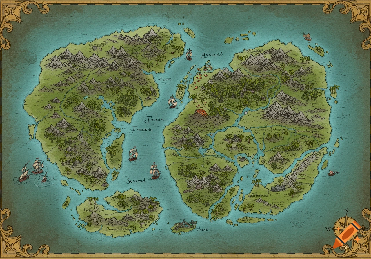
An antique-style Azimuthal Equidistant projection map centered on the North Pole, featuring a reconstructed northern landmass labeled "Terra de Iesso" and "Anian Regnum Gog et Magog." The map shows "America" with "California Ins." and "Tartary," with grid lines and degree markings. The style is detailed and aged.
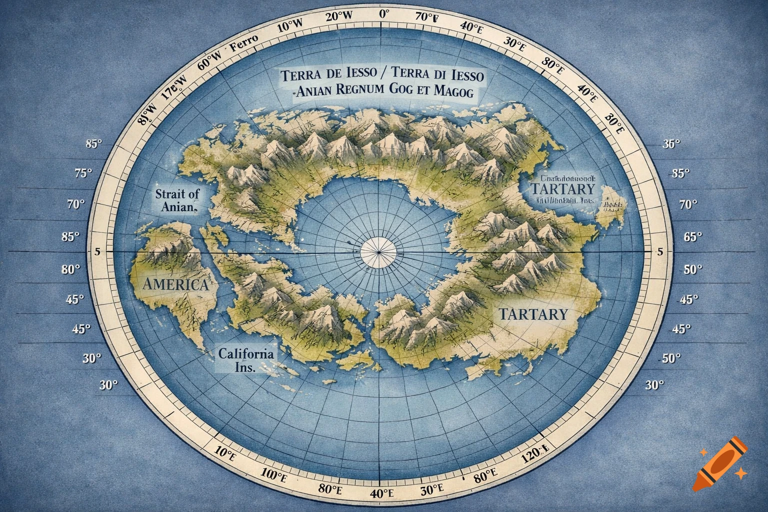
Generate a high-resolution scientific cartographic reconstruction of a flat world map using an Azimuthal Equidistant projection centered on the True Geographic North Pole. The map should present a measured, analytical appearance, combining early modern cartographic knowledge with corrected geometric structure. Core Reconstruction Restore a large northern landmass historically omitted or fragmented on later maps, positioned between North America, Eastern Asia (Kamchatka / Tartary), and Greenland. This reconstructed landmass must: Span approximately 45–60 degrees of longitude and 20–30 degrees of latitude Be labeled with historically attested names: Terra de Iesso / Terra di Iesso Anian Regnum Gog et Magog Be bounded by two clearly defined straits, both labeled “Strait of Anian”, one separating it from Asia, the other from North America Show continuous coastlines, not speculative fades Contain a ring of mountainous terrain enclosing a largely undeveloped interior Corrected Geometry & Grid Display fully restored longitude, correcting the compression seen on later maps Meridians spaced evenly through the reconstructed landmass Latitude lines every 5° (major) and 1° (minor) Longitude lines every 5° (major) and 1° (minor) Clearly labeled degrees along the map border Include multiple historical prime meridians: Ferro Paris Jerusalem Greenwich (not dominant) Continental Configuration North America shown with California as an island Asia labeled broadly as Tartary, with Kamchatka See more