A flat, 2D blueprint map of Ecoluna, a sustainable city on Socotra Island, with white linework on a blue grid. It details various zones like City Hall, University, Solar Plant, and Nature Reserve.
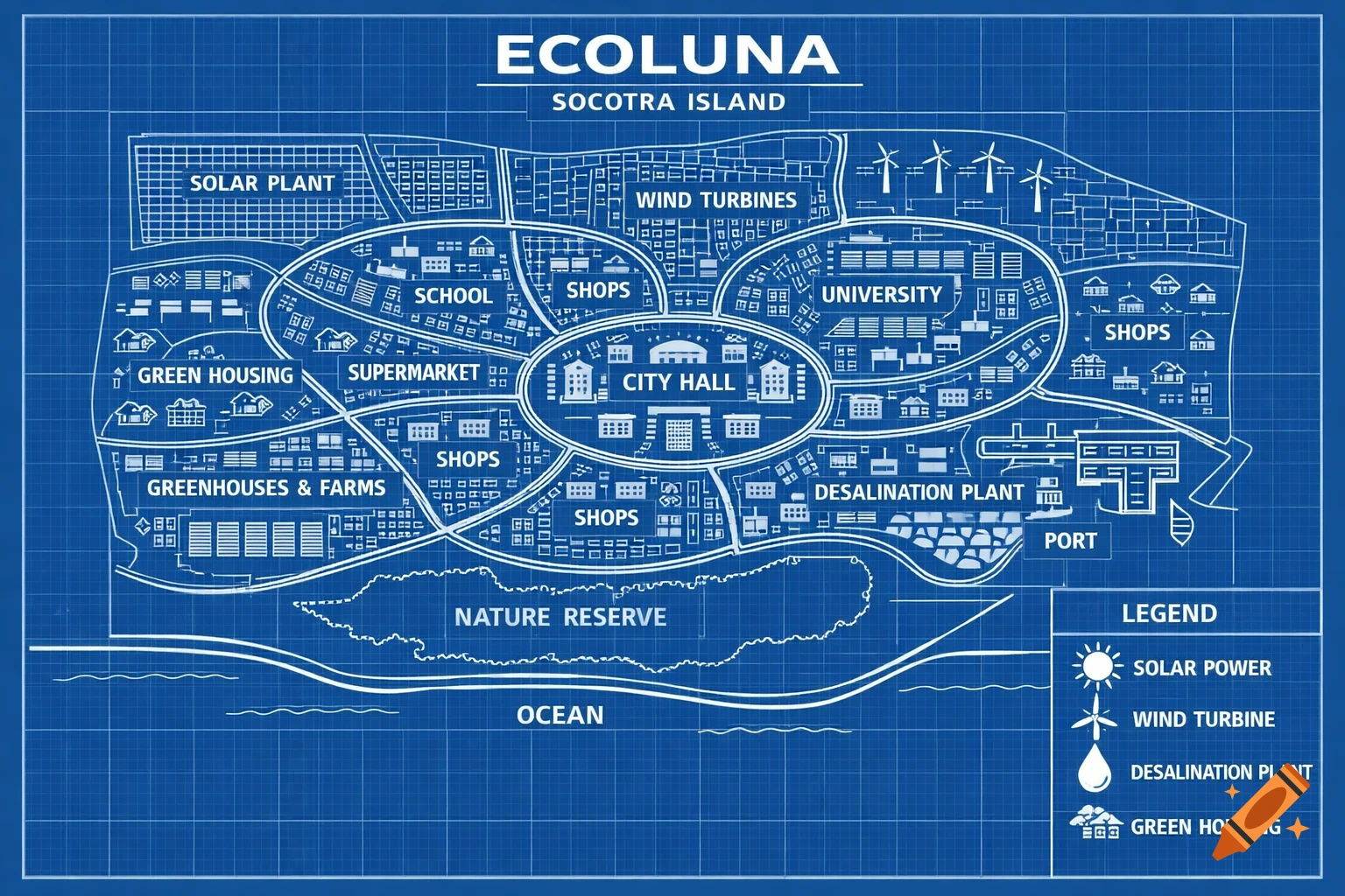
A fully 2D, flat, bird’s-eye blueprint map of a sustainable city called “Ecoluna” on Socotra Island. The map is drawn like an architectural blueprint, with clean white linework on a blue grid background. No 3D perspective, no shadows, no depth — everything is flat and viewed directly from above. The city is spread out over a large area and includes: a central City Hall, multiple schools in different neighborhoods, at least one university, two supermarkets, multiple shops, green housing areas, electric transit routes, greenhouses and farms, a solar power plant, wind turbines, a desalination plant and port, and a protected nature reserve. Curved roads connect all areas logically. All buildings are simple geometric shapes with labels. The coastline and ocean are shown as flat outlines at the bottom of the map. Include a small legend for solar power, wind power, desalination, and green housing. Minimalist, clean, technical drawing style. No color shading, no realism, no 3D effects. See more